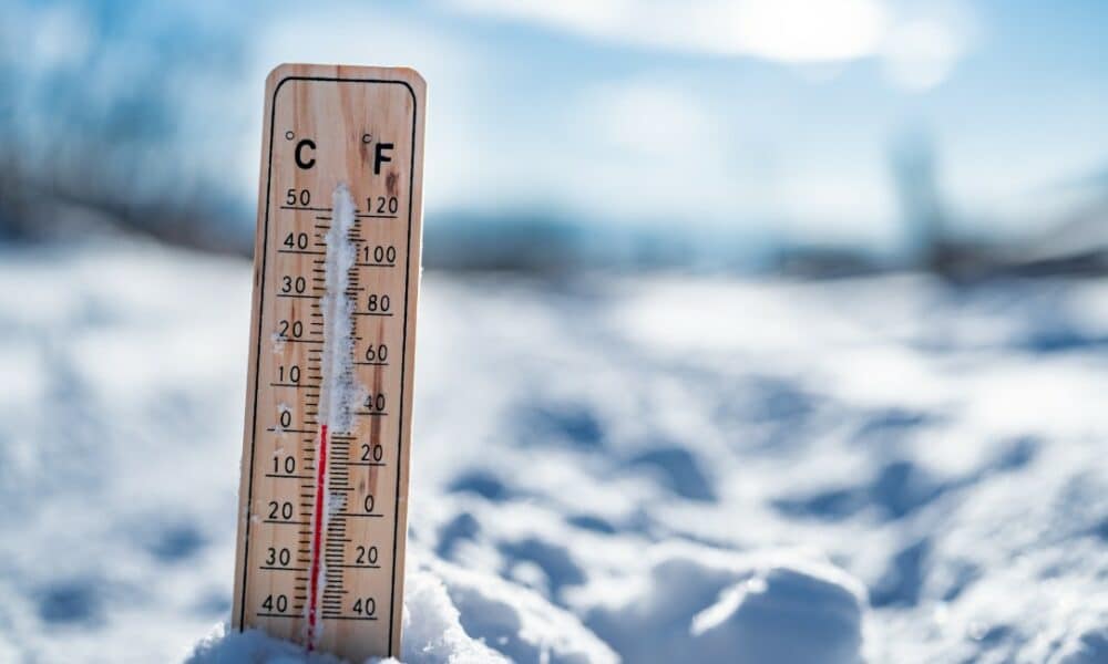
A massive weather event is set to transform North America’s climate in the coming weeks, with meteorologists forecasting a second extreme cold wave in 2025 due to a polar vortex collapse. Following a February marked by record-breaking temperatures and intense blizzards, this phenomenon, driven by a sudden stratospheric warming, promises to unleash Arctic air masses southward, impacting millions across the United States and Canada. Cities like Chicago, New York, Toronto, and Winnipeg may face dramatic temperature drops, biting winds, and snowstorms that will test infrastructure and daily routines. Expected to peak in mid-March, this event arrives at a time when winter should be winding down, catching less-prepared regions off guard with its severity.
The situation stems from a disruption in the polar vortex, a low-pressure atmospheric system that encircles the Arctic, trapping cold air in high latitudes. When destabilized, as is happening now, the jet stream—acting as a natural barrier—weakens, allowing frigid air to spill into southern areas. In the US, the Midwest and Northeast are expected to bear the brunt, while in Canada, provinces like Ontario and Manitoba brace for temperatures that could plummet to -42°C in some spots.
Extreme cold wave threatens US and Canada with polar vortex collapse in March https://t.co/zDEja4Tric
Shared via the Google App
— Larry Knepper (@EmotionalEquine) March 18, 2025
Forecasts suggest not only intense cold but also snowstorms and freezing rain, particularly in coastal regions where Arctic air will clash with moist Atlantic systems. Authorities and emergency services are on high alert, as local populations adjust plans to confront yet another chapter of an unusually harsh winter.
Intensified preparations for the looming cold
With another extreme cold wave on the horizon, cities and states across the United States and Canada are ramping up efforts to mitigate its effects. The polar vortex collapse in February, which led to over 2,300 flight cancellations in the US and left 190,000 people without power in the Midwest, has informed current preparations. Airports like Minneapolis-Saint Paul are bolstering de-icing operations, while highways in Manitoba undergo preemptive inspections to prevent snow-related closures.
Schools in Michigan are considering suspending in-person classes, and businesses in Ontario are adapting operations to protect workers. This swift response reflects an adjustment to a winter that has already proven unpredictable and turbulent, with extreme weather events pushing community resilience to the limit.
Unpacking the polar vortex collapse
The polar vortex collapse is not a standalone event but a complex process involving dramatic shifts in the upper atmosphere. Situated in the stratosphere, between 10 and 50 kilometers above Earth’s surface, the polar vortex is a system of powerful winds—sometimes exceeding 250 km/h—swirling around the Arctic. During the Northern Hemisphere’s winter, from November to March, it strengthens, acting as a barrier that keeps cold air locked in the far north. However, a sudden stratospheric warming event, marked by a temperature spike of up to 50°C in the stratosphere over just a few days, can destabilize this structure.
Known as Sudden Stratospheric Warming (SSW), this warming disrupts the vortex’s winds, which typically blow from west to east. When these winds weaken or reverse, the jet stream—located in the troposphere at about 8 to 11 kilometers altitude—begins to waver. These undulations allow Arctic air, previously confined to the North Pole, to surge southward, bringing extreme temperatures and erratic weather. In March, this event stands out as it occurs late in the winter season, when temperatures are usually on the rise.
Meteorologists note that the current collapse could outstrip February’s in intensity, with projections suggesting the jet stream might split into two branches, potentially extending the cold’s effects for up to seven weeks in some areas. A high-pressure system over northeastern Canada and Greenland, paired with low-pressure systems over the US, is creating a pathway for the Arctic air’s advance, impacting regions from the American Midwest to central Canadian provinces.
Expected impacts across the US and Canada
In the United States, the Midwest and Northeast are poised for the harshest conditions, with temperatures expected to drop as much as 15°C below seasonal averages. Chicago could see lows of -34°C, while New York might hit -20°C, figures rivaling the coldest days of recent winters. The Great Lakes region and Ohio Valley are also in the path of significant snowfalls, with accumulations potentially exceeding 30 centimeters in some spots. Further south, cities like Atlanta and Charlotte, less equipped for cold, could experience subzero temperatures, a rarity for March.
In Canada, Ontario and Manitoba face an even more extreme outlook. Toronto may reach -25°C, and Winnipeg, known for its brutal winters, could plummet to -42°C, with strong winds amplifying the wind chill. The US East Coast also risks freezing rain and snow buildup, as Arctic air collides with Atlantic moisture. These conditions are likely to strain power grids—already tested in February—and disrupt transportation, with road closures and flight cancellations anticipated.
Timeline of the March weather event
The polar vortex collapse follows a sequence of atmospheric developments already underway. Here’s the projected timeline for the coming days:
- Onset of disruption: The sudden stratospheric warming began forming in early March, with initial signs of the polar vortex weakening detected around March 4.
- Peak collapse: Between March 15 and 18, stratospheric winds are expected to hit their lowest point, with the jet stream starting to release Arctic air southward.
- Main impacts: Starting March 20, temperatures are set to plunge across much of the US and Canada, with the most severe effects anticipated for late March into early April.
This timeline reflects the latest projections, though meteorologists caution that the cold’s duration and reach could shift based on stratosphere-troposphere interactions.
Practical steps to weather the extreme cold
As the intense cold nears, authorities and experts recommend several measures to safeguard the public. Here are key tips:
- Keep emergency kits stocked at home and in vehicles, including blankets, non-perishable food, water, and portable chargers.
- Protect exposed pipes from freezing, especially in areas unaccustomed to subzero temperatures.
- Limit outdoor time and wear layered clothing to reduce exposure to biting winds.
- Stay updated with local weather alerts for real-time developments.
These precautions are critical in regions prone to power outages and road blockages, where access to essential services could be disrupted.
Lessons from February and adapting to the new event
February’s polar vortex collapse left a lasting mark, with the Midwest facing blackouts that stranded thousands without heat and Alberta’s rural areas isolated by blizzards in Canada. These incidents exposed vulnerabilities in power grids and transportation systems, prompting a stronger response for March. In the US, states like Michigan and Ohio are stockpiling road salt, while Manitoba expands highway maintenance crews in Canada.
Past experiences have also shaped local decisions. Schools and businesses adjust schedules, and residents stockpile supplies ahead of time. This adaptation underscores a collective push to tackle a winter that, even in its final stretch, continues to astonish with its ferocity and unpredictability.
Regions on high alert and detailed forecast
The areas most at risk from the polar vortex collapse span a wide swath of North America. In the US, the Midwest—including Illinois, Indiana, and Wisconsin—faces the lowest temperatures, with fierce winds heightening the cold. The Northeast, from New York to Massachusetts, anticipates snowfalls that could snarl traffic in major cities. In the South, states like Tennessee and the Carolinas, less accustomed to such weather, brace for freezing rain and potential infrastructure damage.
In Canada, Ontario and Manitoba top the list of concerns, with forecasts of extreme cold and blizzards that may outdo February’s events. The Great Lakes region, straddling both countries, will be a focal point, with snow accumulations projected to reach up to 50 centimeters in some areas. The mix of cold, wind, and precipitation is set to keep authorities on edge for weeks.
Veja Também:
 a lenda do Manchester United e único escocês a conquistar a Bola de Ouro
 Filha de Claudia Raia e Edson Celulari celebra aniversário reunindo os pais
 Horóscopo do dia: previsão para os 12 signos em 28/01/2025
 Kim Kardashian surpreende seguidores ao resgatar foto de 1994
 Aplicativos da Caixa fora do ar afetam 12,2 milhões com pagamento do FGTS em atraso
 Resultado +Milionária 233 com prêmio de R$ 57 milhões nas Loterias Caixa