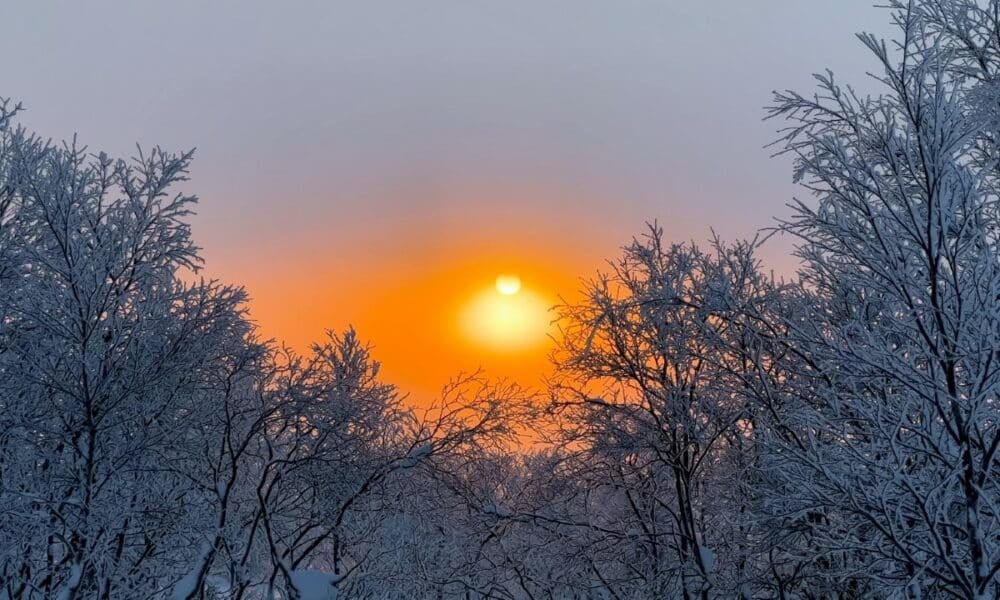
A looming polar vortex collapse is forecast to strike North America by mid-March, promising significant disruptions to weather patterns across the United States and Canada. Meteorologists are warning that this event, the second of 2025, could be particularly potent despite the waning winter season. The first collapse this year hit in mid-February, unleashing a powerful surge of cold air that swept through much of the central and eastern United States, offering a glimpse of the phenomenon’s might. Now, with this new prediction, anticipation is building over how temperatures might plummet and reshape weather conditions across the continent. This event is tied to a Sudden Stratospheric Warming (SSW), which triggers dramatic shifts in high-altitude air circulation.
The polar vortex, a sprawling mass of cold, low-pressure air encircling Earth’s poles, plays a critical role in regulating winter weather. When stable, it works in tandem with the polar jet stream—a high-altitude wind current—to trap frigid air in the Arctic. However, when the vortex weakens or collapses, as anticipated this March, the jet stream becomes more erratic, allowing cold air masses to spill southward into lower latitudes. This leads to sharp temperature drops and extreme weather, impacting millions in regions unaccustomed to such harsh winter conditions. The upcoming event follows a pattern seen earlier this year, raising concerns about its potential reach and intensity.
Unlike February’s episode, which already brought blizzards and below-average temperatures, the March collapse could stand out for its strength, even as winter begins to fade. In the United States, cities in the central and eastern regions, such as Chicago and New York, may face renewed impacts, while Canada, particularly provinces like Ontario and Quebec, is also bracing for effects. The mix of strong winds and icy air is poised to challenge infrastructure, transportation, and daily life, with forecasters keeping a close eye on how this unfolds.
Understanding the polar vortex and its weather influence
The polar vortex is a vast atmospheric structure defined by a large area of low pressure and intensely cold air surrounding Earth’s poles. It strengthens during the Northern Hemisphere’s winter months, from November to March, and weakens in summer due to seasonal temperature shifts. Positioned in the stratosphere, about 30 kilometers above the surface, the vortex is driven by winds exceeding 155 mph, rotating counterclockwise around the Arctic. This motion keeps cold air locked in polar regions, but any disturbance can unleash dramatic climate shifts further south.
A stable vortex pairs with a robust jet stream, acting as a barrier that prevents Arctic air from invading mid-latitude areas like the United States and southern Canada. Under these conditions, weather remains more predictable, with temperatures aligning with seasonal norms. Conversely, a collapsing vortex destabilizes this airflow, enabling cold masses to drift southward. This is often linked to Sudden Stratospheric Warming, where stratospheric temperatures spike by up to 50°C in mere days, disrupting the vortex’s winds. These winds may slow or reverse, throwing atmospheric circulation into disarray and pushing frigid air into regions unprepared for such extremes.
This phenomenon directly influences everyday weather. When the jet stream weakens and becomes wavier, it allows Arctic air to reach lower latitudes, triggering cold snaps, snowstorms, and high winds. In North America, this can mean a stark departure from typical March weather, transforming a month often associated with spring’s onset into one marked by wintry conditions. The interplay between the vortex and jet stream underscores its power to reshape climates across vast distances.
Expected impacts of the March collapse across North America
The forecasted polar vortex collapse in mid-March raises alarms for the United States and Canada, especially after February’s taste of its effects. Back then, escaping Arctic air drove temperatures down sharply, with places like Minneapolis dipping below -20°C and snowstorms halting traffic in states like Michigan and Ohio. This time, experts suggest the event could pack an even stronger punch, potentially affecting a broader area and lingering for days or weeks, depending on the jet stream’s behavior. The heightened intensity poses risks as the season transitions.
In the United States, the Midwest and Northeast are prime targets, still reeling from February’s chill. Chicago saw biting winds and snow pileups that snarled commutes and strained power grids earlier this year, and similar scenes could replay. In Canada, provinces like Manitoba and Alberta, already seasoned to tough winters, might face amplified conditions, with plummeting temperatures and wind chills pushing thermal sensations to extremes. Coastal regions, such as the U.S. East Coast, could also see increased precipitation—think freezing rain or snow—as cold air clashes with Atlantic moisture systems.
Potential impacts include:
- Temperature drops of up to 15°C below average in cities like New York and Toronto.
- Snowstorms disrupting highways and airports.
- Surging energy demands for heating, testing electrical networks.
- Risks of frozen pipes in homes and buildings.
These effects highlight how a polar vortex collapse can turn March into an unexpectedly harsh extension of winter, catching many off guard.
Timeline and history of polar vortex events in 2025
The year 2025 has already logged two notable polar vortex disruptions, underscoring the phenomenon’s frequency and force. The first collapse, in mid-February, unleashed a cold wave impacting over 150 million people in the United States, with record lows in some areas and blizzards halting life in cities like Boston and Detroit. Now, with a second event slated for March, scientists are tracking stratospheric conditions to pinpoint what’s driving these back-to-back disturbances. The rapid succession has sparked interest in how climate patterns might be shifting.
Here’s a timeline of this year’s events:
- February 2025: Initial polar vortex collapse, releasing cold air across the U.S. central and eastern regions.
- March 2025: Second collapse projected for mid-month, targeting the U.S. and Canada.
- Ongoing monitoring: Forecasters watch for additional disruptions before winter ends.
These incidents reinforce the link between polar vortex behavior and extreme cold snaps, a trend increasingly evident in recent years amid global climate variations. The recurrence in 2025 emphasizes the need for readiness in areas vulnerable to sudden weather shifts.
Preparations and responses to the looming weather event
With the March polar vortex collapse on the horizon, North American authorities and residents are gearing up. In the U.S., Midwest cities are stockpiling road salt and checking heating systems in public buildings. States like Minnesota and Wisconsin, tested by February’s freeze, have emergency crews on standby for potential power outages from fierce winds or heavy snow. In Canada, Ontario and other provinces are boosting shelter capacities to shield vulnerable populations, reflecting lessons learned from earlier this year.
Residents are also taking action. Urban centers like Toronto and Chicago report rising demand for portable heaters and thermal blankets, while local weather services issue warnings about hypothermia and frostbite risks. Schools and businesses are weighing closures or remote operations if conditions worsen as projected. February’s experience informs these efforts, but March’s anticipated strength heightens vigilance across affected regions.
The event also spotlights weather’s unpredictability, even in a transitional month like March. As the polar vortex reshapes temperatures and wind patterns, the United States and Canada brace for another test of resilience, with millions tracking updates closely.
Veja Também:
 São Paulo vence Corinthians por 3 x 2 e conquista a Copinha 2025 em final histórica
 Mavi e Viola protagonizam embate decisivo em ‘Mania de Você’: trama promete reviravolta surpreendente
 documentação, prazos e calendário de pagamentos
 Seguro obrigatório retorna com novas regras, valores e impactos nos estados
 Marcelo Rubens Paiva analisa o Oscar e destaca chances de vitória do Brasil com “Ainda Estou Aqui”
 Mulher perde R$ 200 mil em golpe do bilhete premiado em Toledo, Paraná, e caso alerta para nova onda de fraudes